Vikos Canyon
Erstbefahrung des Vikos und der Vikos-Schlucht in ihrer gesamten Länge mit dem Kajak im Mai 1980
First descent of the Vikos river and the Vikos canyon in its complete length by kayak in May 1980
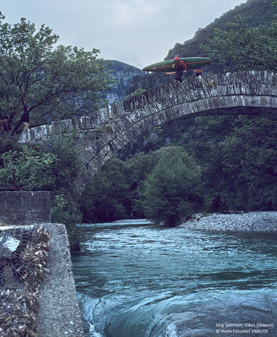
Unser Einsatzort für die Vikos-Schlucht: Kokkorou Brücke
Our put-in for the Vikos Canyon: Kokkorou Bridge
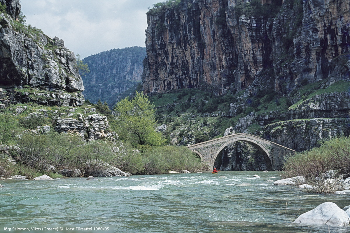
Nach wenigen Paddelschlägen folgt schon die Missios Brücke über den Vikos
A few paddle strokes further down follows the Missios bridge over the Vikos river
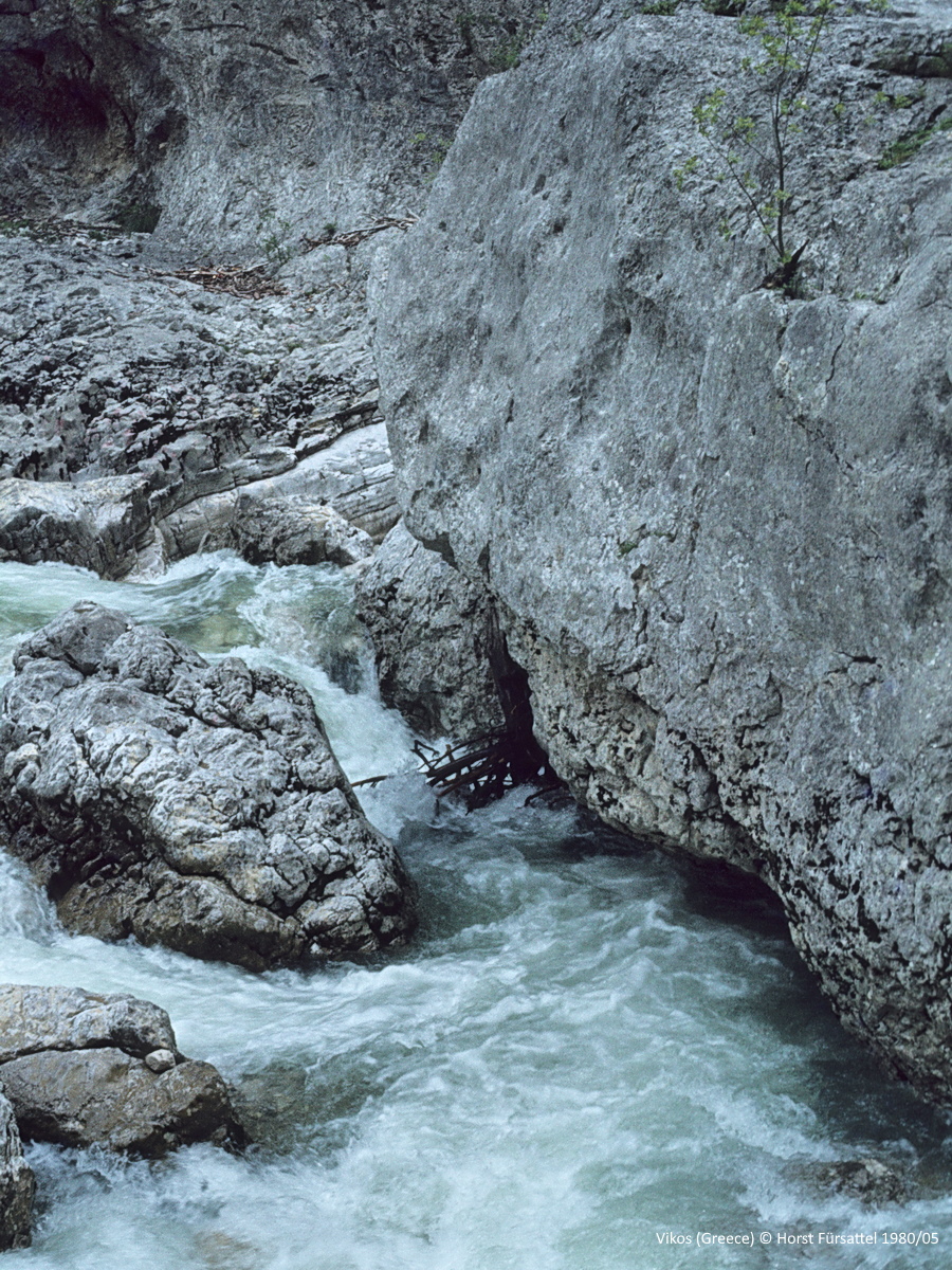
Umtragestelle. Im Siphon steckt jede Menge Treibholz und links zieht es in einen Wasserfall
Portage. There is a lot of driftwood in the siphon and a waterfall is hidden on the left side
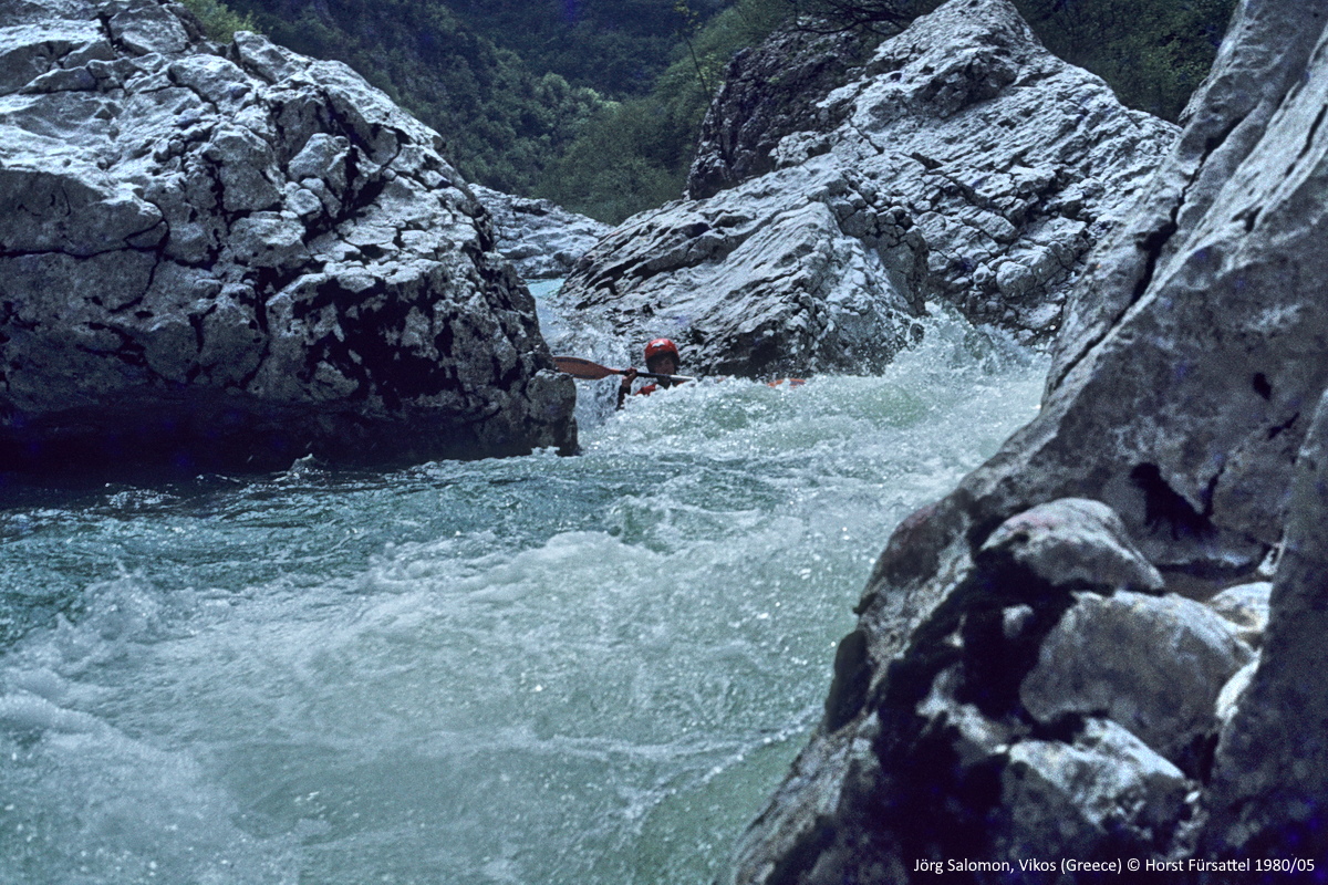
Nach dem Wasserfall wurde die Situation etwas unübersichtlich
After the waterfall the situation became a bit obscure
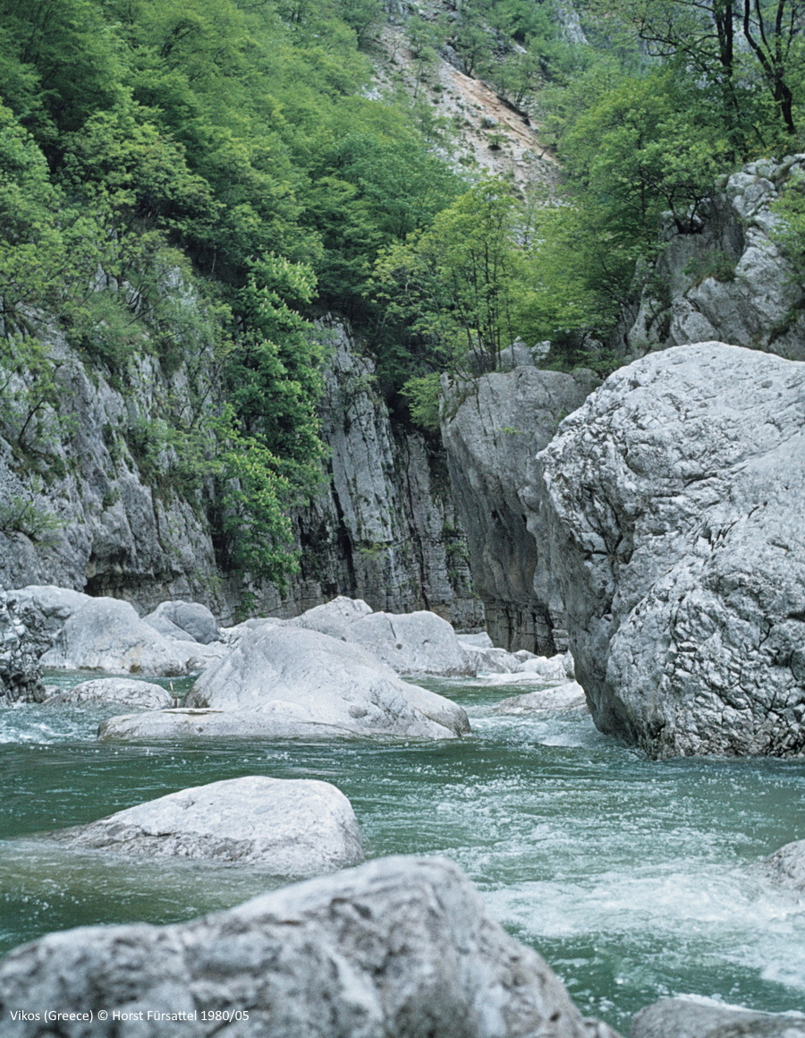
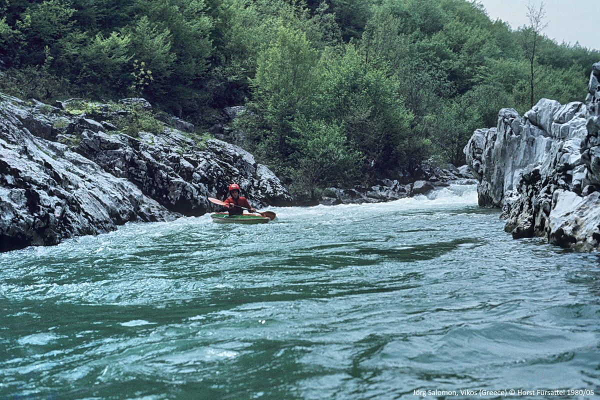
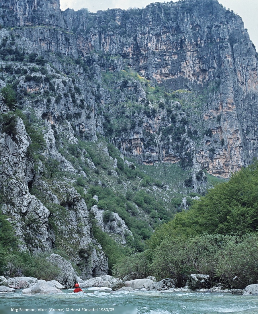
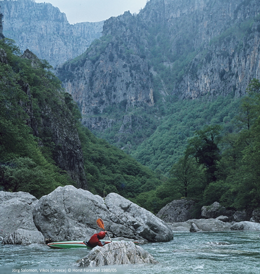
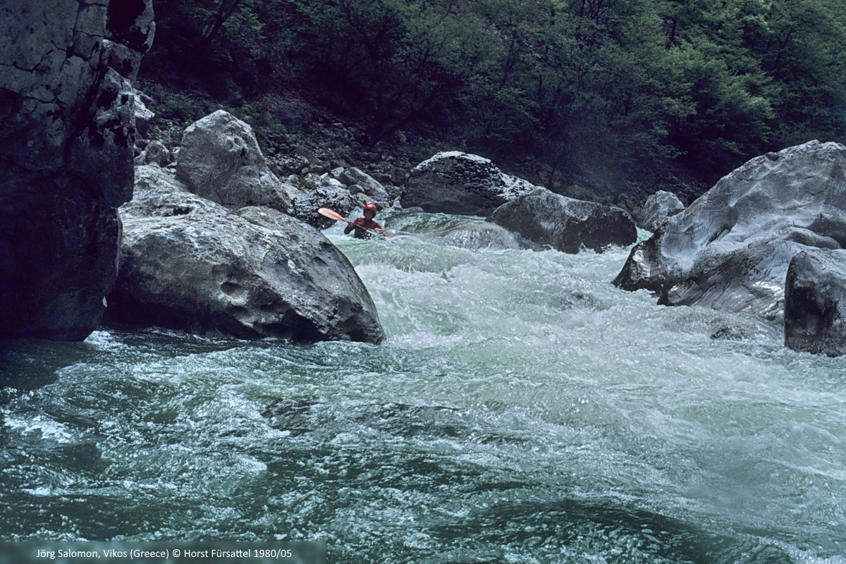
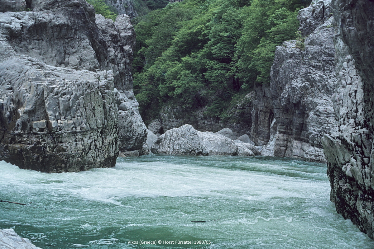
Reichlich Blöcke, einige Unterspülungen, Siphone und glatte Canyonwände im Kernstück des Vikos
Plenty of boulders, some undercuts, siphons and sleek canyon walls in the core section of the Vikos river
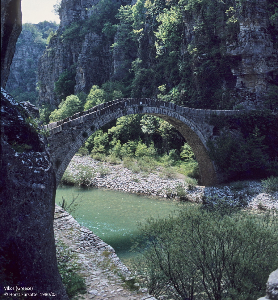
Ende unserer Fahrt an der Klidonia Brücke
End of our trip at the Klidonia bridge
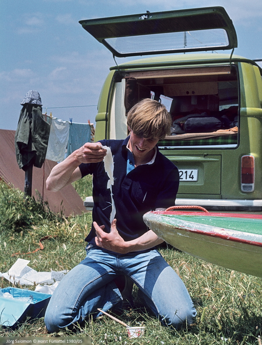
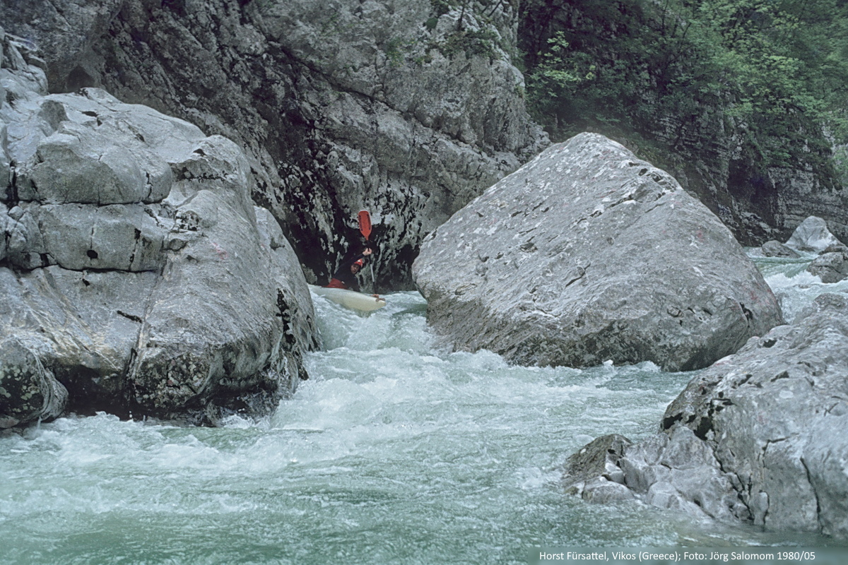
Endlich Gelegenheit: Jörg Salomon beim Beseitigen der Spuren einiger früherer Fahrten
Finally the opportunity: Jörg Salomon removing the traces of some previous trips
Im Pindos-Gebirge hatte es gleich nach unserer Vikos-Fahrt wieder begonnen zu regnen, an der Ägäis schien die Sonne. Also erst einmal ab ans Meer...
It had begun to rain again in the Pindus mountains just after our Vikos trip, while the sun was shining on the Aegean Sea. So we went to the sea next...
- - - - -
Am 16. Mai 1980 waren wir mit der Fähre in Igoumenitsa angekommen, hatten dann einen Tag zum Kundschaften an den Flüssen um den Katarapass verbracht und am 18. Mai 1980 standen wir auf der Kokkorou-Brücke im Pindos-Gebirge. Unter uns strömte glasklares Wasser, das musste der Oberlauf des Voidomatis sein. Allerdings wird er hier oben Vikos genannt und zeigt meist nur sein trockenes Flussbett. Weiter abwärts, in der Vikos-Schlucht, liegt eine ganzjährig aktive Karstquelle. Diese Quelle gilt als Voidomatis-Ursprung.
Der genaue Flussname war uns erst einmal egal; wir waren schon tagelang mit Auto und Fähre unterwegs. Wir wollten endlich paddeln und der Bach sah verlockend aus.
Mit uns hatten wir eine Beschreibung aus dem "Österreich Kanu-Sport", dort war als Einsatzort diese Karstquelle in der Schlucht genannt. Um dorthin zu gelangen hätten wir damals wieder zurück auf die Hauptstraße gemusst, also voraussichtlich noch einmal 1-2 Stunden Fahrt plus eine weitere halbe Stunde Abstieg zur Quelle. So viel Zeit wollten wir uns nicht nehmen, es war schon Mittag. Wir beschlossen an der Kokkorou-Brücke einzusteigen, die oberen 12 Kilometer der Schlucht mit dem Boot zu paddeln um anschließend den Voidomatis zu befahren. Auf dem Voidomatis sollten es bis zum Aussatzort an der Kleidonia-Brücke dann noch etwa 12 Kilometer sein, durchgehend befahrbar und mit abnehmenden Schwierigkeiten.
In dieser Flussbeschreibung wurde vor der oberen Etappe, dem besagten Vikos, allerdings gewarnt: Gemäß Auskunft Ortskundiger sollte der Fluss bald unterirdisch verschwinden. Das deckte sich mit Hinweisen aus einem Wanderführer durch die Vikos-Schlucht. Demnach sei "das Begehen des Wasserlaufs (im Sommer trocken) beschwerlich, endlose Felsstufen müssen erklettert bzw. hinabgeklettert werden."
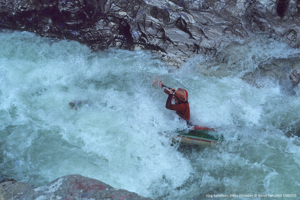
Aber jetzt war nicht Sommer und außerdem hatte hier viel geregnet, damit bestand nach unserer Einschätzung eine gute Chance auf eine interessante Wildwasserfahrt auf einem unbekannten Fluss. Genau so kam es dann auch: nach wenigen Paddelschlägen befanden wir uns in einer grandiosen Schlucht wie wir sie bis dahin nur vom Verdon in Frankreich kannten. Der Fluss lieferte dazu sportliches Wildwasser. Nicht alles war fahrbar, einmal stürzte sich der Vikos in einen total verholzten Siphon und kam kurz darauf mit einem fetten Wasserfall wieder ans Tageslicht.
Wir waren zu zweit unterwegs und ein eingespieltes Team, deshalb kamen wir trotz der Umtragestellen schnell voran. Nach einiger Zeit verdoppelte sich die Wassermenge unterm Boot, offensichtlich hatten wir die Voidomatis-Quelle passiert. Somit hatten wir den Vikos befahren und den Voidomatis erreicht. Dank der kräftigen Quellschüttung spülte es uns flott durch den Rest der Schlucht. An der Kleidonia-Bogenbrücke wartete auch schon mein Vater mit dem Auto. Besser hätte es nicht klappen können: circa 25 Kilometer abenteuerliche Wildwasserfahrt durch einen der großen Canyons Europas lagen hinter uns.
Von einer früheren Befahrung des Vikos, dem Fluss oberhalb der Voidomatis-Quelle, ist uns nichts bekannt. Unsere Tour dürfte die erste Befahrung des Vikos und des Vikos-Canyons in seiner vollen Länge gewesen sein.
- - - - -
On 16 May 1980 we arrived in Igoumenitsa by ferry, spent a day exploring the rivers around the Katara Pass and on 18 May 1980 we stood on the Kokkorou Bridge in the Pindos Mountains. Crystal clear water was flowing below us, this must be the upper part of the Voidomatis. However, up here it is called Vikos and usually shows only its dry riverbed. Further down, in the Vikos gorge, there is a karst spring which is active all year round and is considered to be the origin of the Voidomatis.
The exact name of the river did not matter to us at this point; we had already been on the way far too long. We just wanted to paddle and the river looked attractive.
We had a description from the "Österreich Kanu-Sport" with us, where the karst spring in the middle of the gorge was specified as the put-in. To get there, we would have had to return to the main road, so probably another 1-2 hours drive plus half an hour descent to the spring. We did not want to spend so much time, it was already noon. So we decided to put-in at the Kokkorou bridge, paddle the first 12 kilometres of the canyon and then continue paddling the Voidomatis. The Voidomatis should be another 12 kilometres to the take-out at the Kleidonia Bridge, all runnable and with decreasing difficulties.
In this river guide, however, a warning was given about the upper section, the above-mentioned Vikos: according to local people, the river should soon disappear underground. This was confirmed by information from a hiking guide through the Vikos gorge. According to this, "walking along the watercourse (dry in summer) is difficult, endless rock steps have to be climbed or descended."
But now it wasn't summer and there had been a lot of rain, so we thought there was a good chance for an amazing ride on an unknown river. And that's exactly how it happened: after a few paddle strokes we found ourselves in a spectacular gorge, which we had only known from the Verdon in France until then. The river provided exciting white water. Not all was runnable, once the Vikos plunged into a huge siphon and came back to daylight next to a waterfall.
There were two of us, and we were a well-coordinated team, so we made fast progress despite the portages. After a while the volume of water under our boats doubled, obviously we had passed the Voidomatis spring. We had paddled the Vikos river and reached the Voidomatis. Thanks to the additional water we were flushed through the rest of the gorge quickly. At the Kleidonia bridge my father was already waiting with the car. It couldn't have worked better: approximately 25 kilometres of adventure-packed white water kayaking through one of Europe's largest canyons lay behind us.
We are not aware of any previous paddling on the Vikos, the river above the Voidomatis spring. Our tour was probably the first descent of the Vikos and the Vikos Canyon in its complete length.
Kayakers: Jörg Salomon, Horst Fürsattel
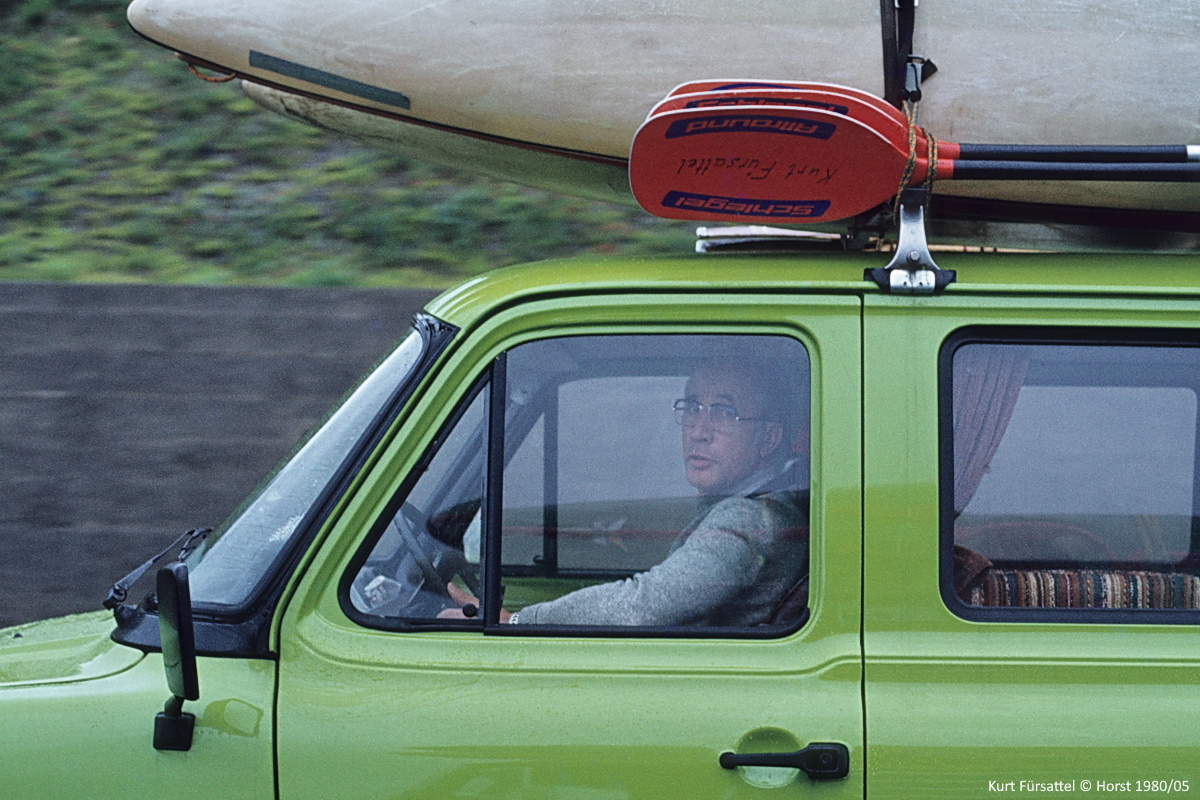
Inspiration, support & shuttle: Kurt Fürsattel
Unsere Quellen:
Österreichs Kanu-Sport 5/6 1978, Klaus Juranek
Bergwelt Griechenland, Fink-Kümmerly+Frey, 1979, Orestis M. Colettis, Seite 62
Straßenkarte Epirus, Blatt Ionnina, 1969